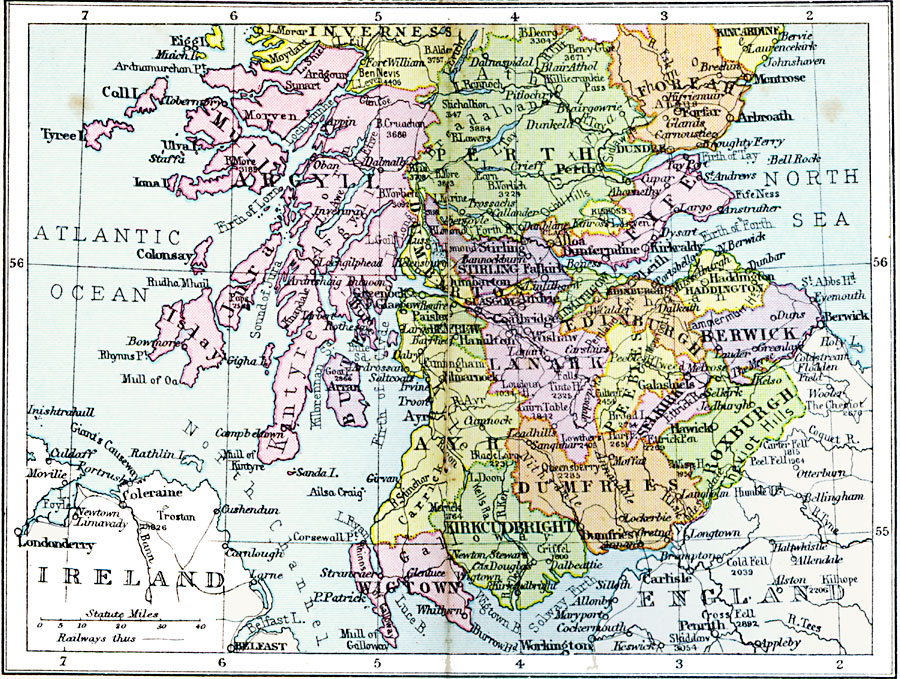
Description: A regional map of southern Scotland from 1920, showing major cities, towns, and ports, railways and canals, and counties. The map shows major rivers and prominent peaks with elevations in feet. The map is color–coded to show the counties.
Place Names: United Kingdom, Argyll, �Mull, �Perth, �Inverness, �Forfah, �Fife, �Stirling, �Lanark, �Ayr, �Dumfries, �Berwick, �Roxburgh, �Kirkcudbright, �Wigtow
ISO Topic Categories: boundaries,
inlandWaters,
location,
oceans,
transportation
Keywords: Scotland Plate II, physical, �political, �transportation, physical features, major political subdivisions,
country borders, railroads, boundaries,
inlandWaters,
location,
oceans,
transportation, Unknown, 1920
Source: , Asprey's Atlas of the World (London, England: Asprey and Co., Ltd., 1920) 36
Map Credit: Courtesy the private collection of Roy Winkelman |
|