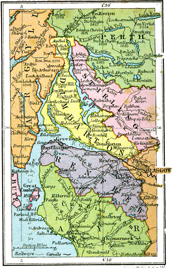
Description: A map of west–central Scotland from 1920, showing County Dumbarton and County Renfrew near the River Clyde, and portions of Argyll, Perth, Stirling, Glasgow, Ayr, and Bute counties. The map shows the Firth of Clyde (Lower Clyde), and major cities and towns, railways, rivers, and mountains of the area. This map shows the Trossachs of Perth, an area made famous in the works of Sir Walter Scott, particularly Loch Katrine in "Lady of the Lake."
Place Names: United Kingdom, Argyll, �Ayr, �Renfrew, �Dumbarton, �Stirling, �Pert
ISO Topic Categories: boundaries,
inlandWaters,
location,
oceans,
transportation
Keywords: Trossachs and Lower Clyde, physical, �political, �transportation, physical features, major political subdivisions, railroads,
water routes, boundaries,
inlandWaters,
location,
oceans,
transportation, Unknown, 1920
Source: , Asprey's Atlas of the World (London, England: Asprey and Co., Ltd., 1920) 37
Map Credit: Courtesy the private collection of Roy Winkelman |
|