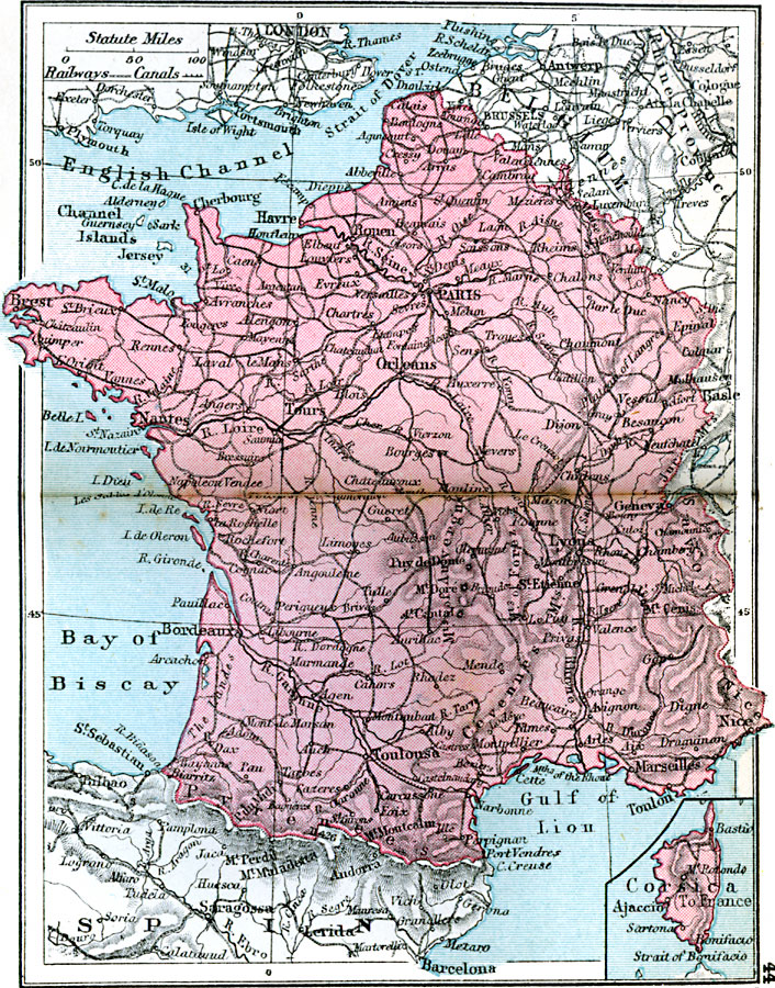
Description: A map of France in 1920, showing major cities and towns, canals, railroads, rivers, and terrain, and an inset map of the island of Corsica.
Place Names: France, Havre, �Nantes, �Bordeaux, �Toulouse, �Toulon, �Marseilles, �Nice, �Orleans, �Paris, �Genev
ISO Topic Categories: boundaries,
inlandWaters,
location,
oceans,
transportation
Keywords: France, physical, �political, �transportation, physical features, country borders, railroads,
water routes, boundaries,
inlandWaters,
location,
oceans,
transportation, Unknown, 1920
Source: , Asprey's Atlas of the World (London, England: Asprey and Co., Ltd., 1920) 44
Map Credit: Courtesy the private collection of Roy Winkelman |
|