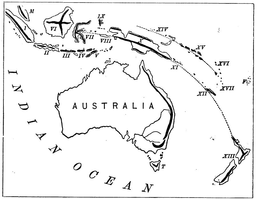
Description: A map from 1873 showing the Australasian chain of islands from the Malay Peninsula to New Zealand. The map is keyed to show: (I) Sumatra; (II) Java; (III) Sumbawa; (IV) Flores; (V) Timor; (VI) Borneo; (VII) Celebes; (VIII) Ceram; (IX) Gilolo; (X) New Guinea; (XI) Louisiade Archipelago; (XII) New Caledonia; (XIII) New Zealand; (XIV) Admiralty Islands; (XV) Solomon Islands; (XVI) Santa Cruz Islands; (XVII) New Hebrides; (F) Feejee Islands; (T) Tasmania; and (M) Malay Peninsula.
Place Names: A Regional Map of Oceania, Sumatra, Java, Sumbawa, Flores, Timor, Borneo, Celebes, Ceram, Gilola, New Guinea, Louisiade Archipelago, New Caledonia, New Zealand, Admiralty Islands, Solomon Islands, Santa Cruz Islands, New Hebrides, Feejee Islands, Fiji, Tasmania, Malay Peninsula
ISO Topic Categories: location,
oceans,
inlandWaters
Keywords: Australasian Chain, physical, physical features, location,
oceans,
inlandWaters, Unknown, 1873
Source: D. M. Warren, Elementary Treatise on Physical Geography (Philadelphia, PA : Cowperthwait and Co., 1873) 17
Map Credit: Courtesy the private collection of Roy Winkelman |
|
