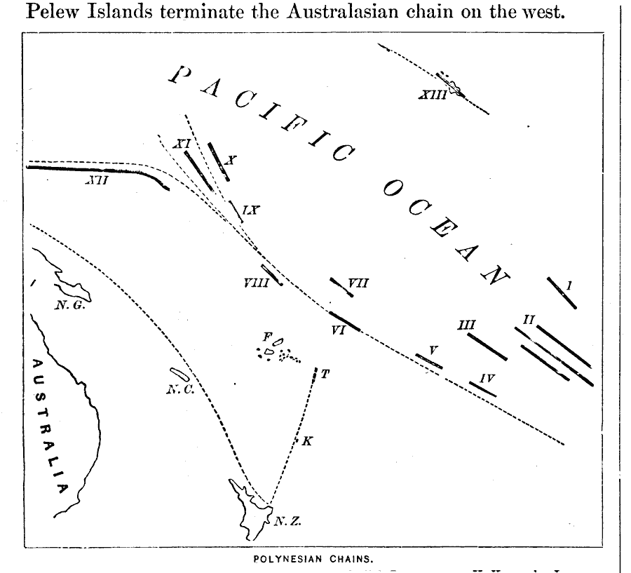
Description: A map of the Polynesian island chains of the Pacific from 1873. The map is keyed to show the Marquesas Islands (I), Paumotu Islands (II), Tahitian Islands (III), Rurutu Islands (IV), Hervey Islands (V), Samoan Islands (VI), Vakaafo Islands (VII), Viatupu Islands (VIII), Kingsmill Islands (IX), Radack Islands (X), Ralick Islands (XI), Caroline Islands (XII), Sandwich Islands (XIII), Feejee Islands (F), Tonga Islands (T), Kermadec Islands (K), New Zealand (N.Z.), New Caledonia (N.C.), and New Guinea (N.G.). "The Polynesian Chains, northeast of Australia, sweep through the centre of the Pacific Ocean, measuring 5500 miles in length. They begin in the southeast, with the Paumotu Islands, the Tahitian Group, Rurutu and Hervey Islands, all lying parallel to each other. Farther west follow the Samoan or Navigators Islands, and the Vaitupu Group. The chains here divide: the Kingsmill, Ralick, and Radack Islands sweep northward, while the long chain of the Caroline Islands trend westward. The Pelew Islands terminate the Australasian chain on the west. The Hawaiian or Sandwich Islands form a chain far to the northeast of the preceding, but preserving the same northwesterly trend." — Warren, 1873, p.18.
Place Names: Regional Pacific Ocean, Australia, �New Zealand, �Papua New Guinea, �Tahitian Islands, �Samoan Islands, �Feejee Islands, �Marquesas Islands, �Sandwich Islands, �Hawaiin Island
ISO Topic Categories: physical, kWorldPacific
Keywords: Polynesian Island Chains, physical, physical features, physical, kWorldPacific, Unknown, 1873
Source: D. M. Warren, Elementary Treatise on Physical Geography (Philadelphia, PA : Cowperthwait and Co., 1873) 18
Map Credit: Courtesy the private collection of Roy Winkelman |
|
