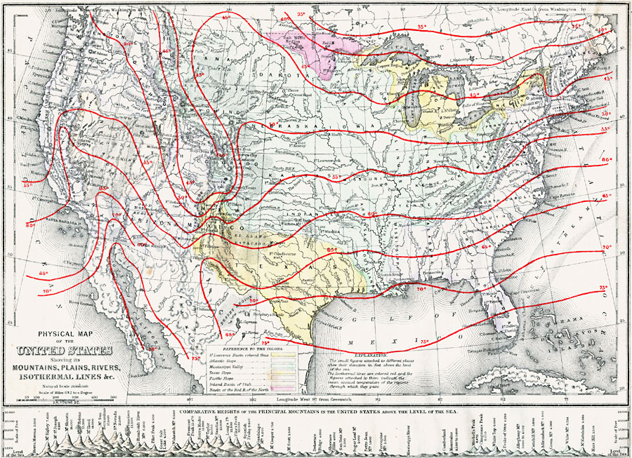
Description: A map from 1873 of the United States showing the physical features of mountain systems, plateaus, basins, plains, rivers, lakes, and coastal features, with elevations given for prominent peaks given in feet above sea level. The map is color–coded to show the St. Lawrence Basin, Atlantic Slope, Mississippi Valley, Texas Slope, Pacific Slope, inland Basin of Utah, and the Basin of the Red River North. The map shows isotherm lines of mean annual temperatures given in degrees Fahrenheit. A chart at the bottom of the map shows comparative heights of the principal mountains.
Place Names: A Complete Map of the United States, temperature, �isothermal line
ISO Topic Categories: location,
inlandWaters,
oceans,
climatologyMeteorologyAtmosphere
Keywords: Mountains, Plains, Rivers, Isothermal Lines of the United States, physical, �meteorological, physical features, temperature, location,
inlandWaters,
oceans,
climatologyMeteorologyAtmosphere, Unknown, 1873
Source: D. M. Warren, Elementary Treatise on Physical Geography (Philadelphia, PA : Cowperthwait and Co., 1873) 110
Map Credit: Courtesy the private collection of Roy Winkelman |
|