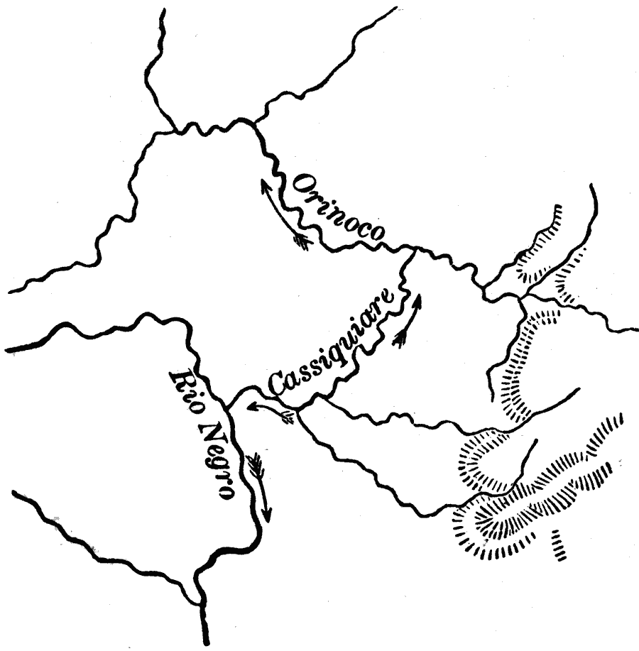
Description: A map from 1873 showing an example of an unusual watershed feature, the division or bifurcation of the Cassiquiare River in Venezuela. "The absence of a distinct watershed allows in some instances one and the same river to divide and to send its branches to different river basins. Such division of a river is called bifurcation. The best known example is the Cassiquiare River in Venezuela, which connects through its bifurcation the river systems of the Amazon and Orinoco Rivers." — Warren, 1873, p. 36.
Place Names: Venezuela, Rio Negro, �Cassiquiare, �Orinoco,
ISO Topic Categories: location,
inlandWaters
Keywords: Bifurcation of the Cassiquiare River, Venezuela, physical, physical features, location,
inlandWaters, Unknown, 1873
Source: D. M. Warren, Elementary Treatise on Physical Geography (Philadelphia, Pennsylvania: Cowperthwait and Co., 1873) 36
Map Credit: Courtesy the private collection of Roy Winkelman |
|