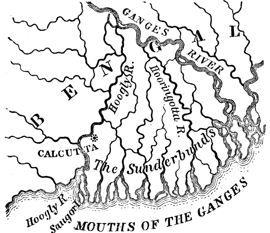
Description: A map from 1873 of the Ganges River delta in what was at the time the Bengal province of British India. The map shows the main course of the Ganges River, the Hoogly and Hooringotta distributaries, and the Sunderbunds at the mouth of the delta on the Bay of Bengal. The map is used to illustrate the term ‘delta’ due to the classic form of the Ganges delta system. "Many rivers empty into the sea through a network of mouths, between which lie low, flat, alluvial islands. These, together with the outlets, are called deltas, from their resemblance to the Greek letter of that name. [...] The delta of the Ganges and Brahmapootra Rivers measures over fifteen thousand square miles. Its numerous islands, called The Sunderbunds, are covered with dense jungles and inhabited by tigers and other wild animals. The capital of India, Calcutta, lies upon one of its branches, which is called the Hoogly River." — Warren, 1873, p. 38.
Place Names: India , India, �Bengal, �Calcutta, �Ganges River, �Sunderbunds, �Hoogly River, �Hooringotta River,
ISO Topic Categories: location,
inlandWaters
Keywords: Delta of the Ganges River, India, physical, physical features, location,
inlandWaters, Unknown, 1873
Source: D. M. Warren, Elementary Treatise on Physical Geography (Philadelphia, PA : Cowperthwait and Co., 1873) 38
Map Credit: Courtesy the private collection of Roy Winkelman |
|