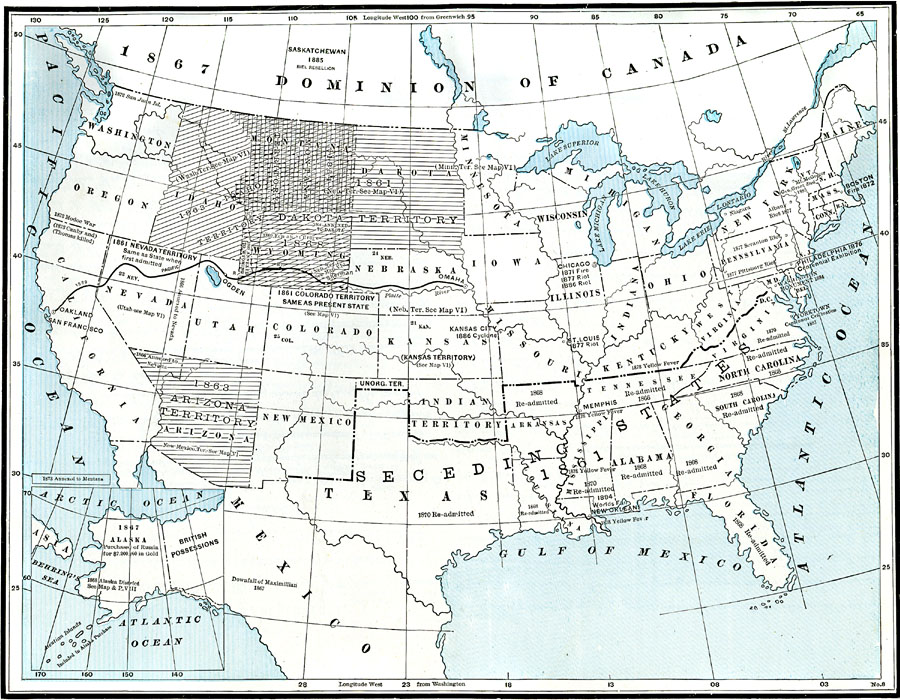
Description: A map of the United States after the American Civil War showing political facts, boundaries, and conflicts regarding the post-Civil War reconstruction (1865–1892).
Place Names: A Complete Map of the United States, Mexico, �Montana Territory, �Dakota Territory, �Colorado Territory, �Nevada Territory, �Arizona Territory, �Kansas Territory, �Seceding States, �emancipation, �post civil wa
ISO Topic Categories: boundaries,
inlandWaters,
location,
oceans
Keywords: Post Civil War United States, physical, �political, �historical, physical features, country borders, historical event,
Civil War, boundaries,
inlandWaters,
location,
oceans, Unknown, 1865–1892
Source: , The American Republic (Chicago, IL: John W. Iliff and Co., 1892) 25
Map Credit: Courtesy the private collection of Roy Winkelman |
|