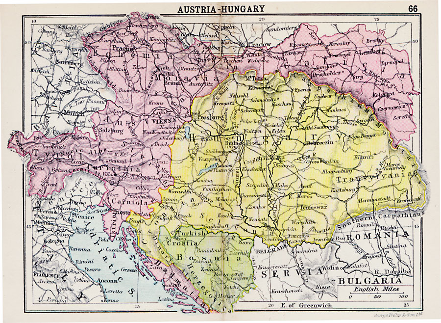
Description: A map showing the extent of the Austria–Hungary territories in 1920, showing districts, possessions, major cities and towns, railroads, rivers, and mountain systems in the region.
Place Names: Austria-Hungary, Prague, �Vienna, �Brunn, �Trieste, �Munich, �Turkish, �Lemberg, �Debreczin, �Belgrade, �Craco
ISO Topic Categories: boundaries,
inlandWaters,
location,
transportation
Keywords: Austria-Hungary, physical, �political, �transportation, physical features, country borders,
major political subdivisions, railroads, boundaries,
inlandWaters,
location,
transportation, Unknown, 1920
Source: , Asprey's Atlas of the World (London, England: Asprey and Co., Ltd., 1920) 66
Map Credit: Courtesy the private collection of Roy Winkelman |
|