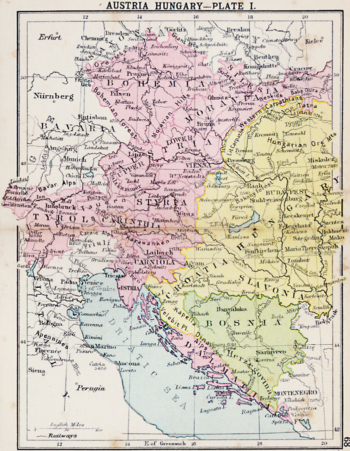
Description: First in a series of regional maps of Austria–Hungary showing the territories in 1920. The map shows major cities and towns, railroads, rivers, and mountain systems.
Place Names: Austria-Hungary, Bohemia, �Silesia, �Moravia, �Styria, �Tyrol, �Croatia, �Hungary, �Bosnia, �Slavonia, �Dalmatia, �Italy, �Bavaria, �Montenegro, �Herzegovin
ISO Topic Categories: boundaries,
inlandWaters,
location,
oceans,
transportation
Keywords: Austria-Hungary , physical, �political, �transportation, physical features, country borders,
major political subdivisions, railroads, boundaries,
inlandWaters,
location,
oceans,
transportation, Unknown, 1920
Source: , Asprey's Atlas of the World (London, England: Asprey and Co., Ltd., 1920) 68
Map Credit: Courtesy the private collection of Roy Winkelman |
|