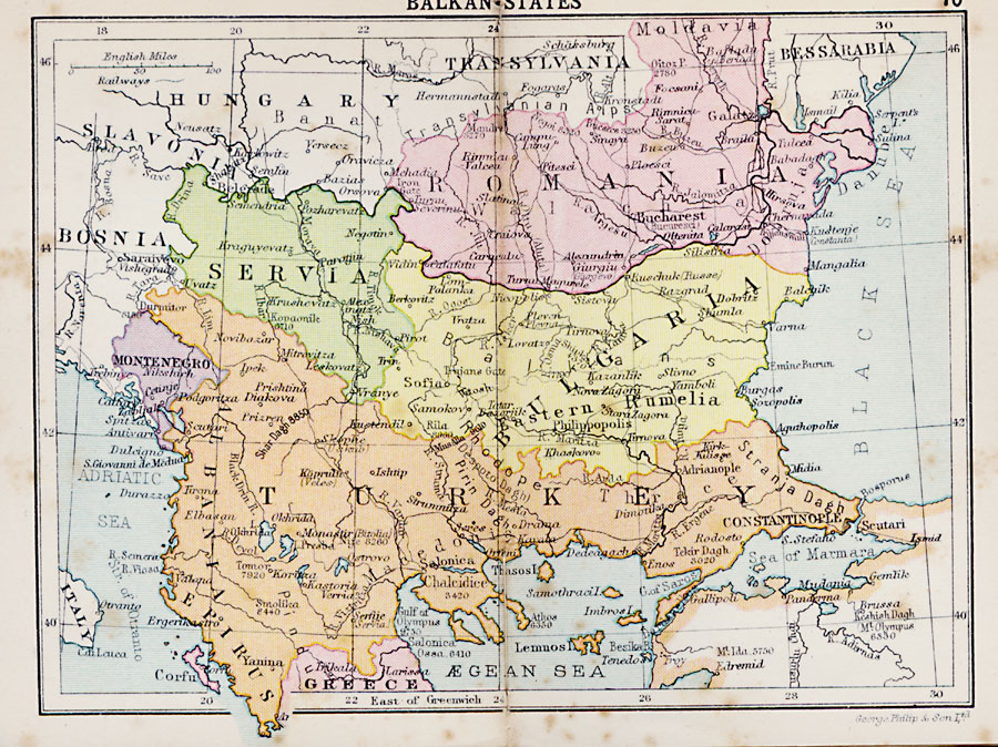
Description: A map from 1920 of the Balkan States including Turkey, country boundaries and capitals, principal cities and towns, railroads, mountain systems, lakes, rivers, islands, and coastal features.
Place Names: Southeastern Europe, Servia, �Romania, �Bulgaria, �Montenegro, �Albania, �Epirus, �Greece, �Turkey, �Constantinople, �Philippopolis, �Transylvania, �Bucharest, �Belgrad
ISO Topic Categories: boundaries,
inlandWaters,
location,
oceans,
transportation
Keywords: Balkan States, physical, �political, �transportation, physical features, country borders,
major political subdivisions, railroads, boundaries,
inlandWaters,
location,
oceans,
transportation, Unknown, 1920
Source: , Asprey's Atlas of the World (London, England: Asprey and Co., Ltd., 1920) 70
Map Credit: Courtesy the private collection of Roy Winkelman |
|