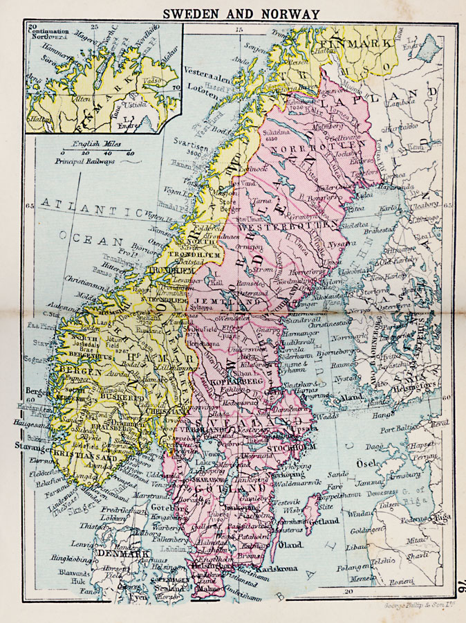
Description: A map of Sweden and Norway in 1920, showing the national boundaries, major cities, ports, and towns, proposed railways, rivers, islands, costal features, and mountain systems. The map also has an inset map of the continuation of the northern portion of Norway's Finmark territory. On this map, the Norwegian capital of Oslo is labeled with the former name "Christiania."
Place Names: Scandinavia, Sweden, �Norway, �Finmark, �Lapland, �Denmark, �Stockhol
ISO Topic Categories: boundaries,
inlandWaters,
location,
oceans
Keywords: Sweden and Norway, physical, �political, physical features, country borders,
major political subdivisions, boundaries,
inlandWaters,
location,
oceans, Unknown, 1920
Source: , Asprey's Atlas of the World (London, England: Asprey and Co., Ltd., 1920) 76
Map Credit: Courtesy the private collection of Roy Winkelman |
|
