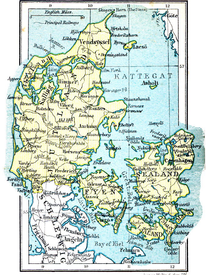
Description: A map of the country of Denmark in 1920, showing cities, towns, and coastal features, and including Jutland and the larger islands of Sealand (Zealand), Fyen (Funen), Laaland (Lolland), and Falster.
Place Names: Denmark, Vendsyssel, �Salling, �Aarcuus, �Thyland, �Copenhagen, �Horsens, �Veile, �Frederici
ISO Topic Categories: boundaries,
location,
inlandWaters,
oceans
Keywords: Denmark, physical, �political, physical features, country borders, boundaries,
location,
inlandWaters,
oceans, Unknown, 1920
Source: , Asprey's Atlas of the World (London, England: Asprey and Co., Ltd., 1920) 77
Map Credit: Courtesy the private collection of Roy Winkelman |
|