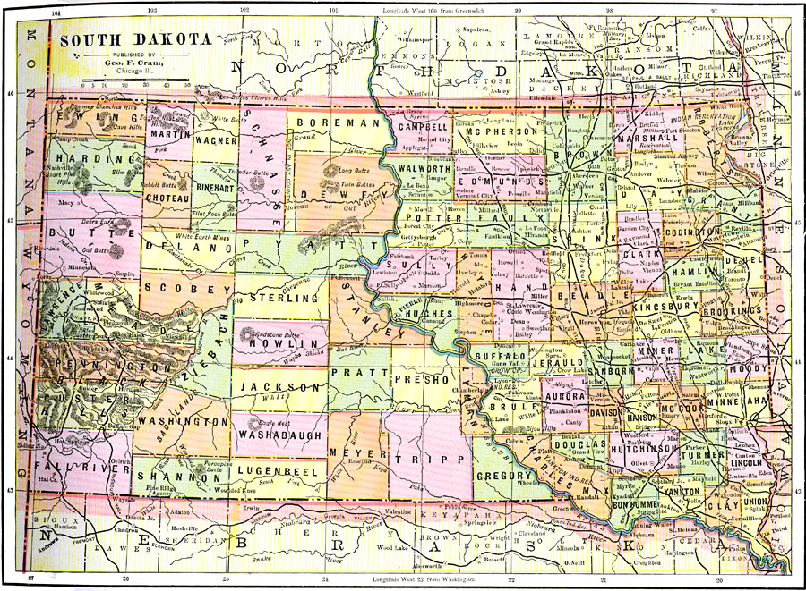
Description: A map from 1892 of South Dakota showing the capital at Pierre, counties and county seats, principal cities and towns, Indian reservations, railroads, mountains, lakes, and rivers.
Place Names: South Dakota, Aberdeen, �Deadwood, �Pierre, �Sioux Falls, �Mitchell, �Brookings, �Huron, �Watertown, �Yankto
ISO Topic Categories: boundaries,
inlandWaters,
location,
transportation
Keywords: South Dakota, physical, �political, �transportation, physical features, county borders, railroads, boundaries,
inlandWaters,
location,
transportation, Unknown, 1892
Source: , The American Republic (Chicago, IL: John W. Iliff and Co., 1892) 59
Map Credit: Courtesy the private collection of Roy Winkelman |
|