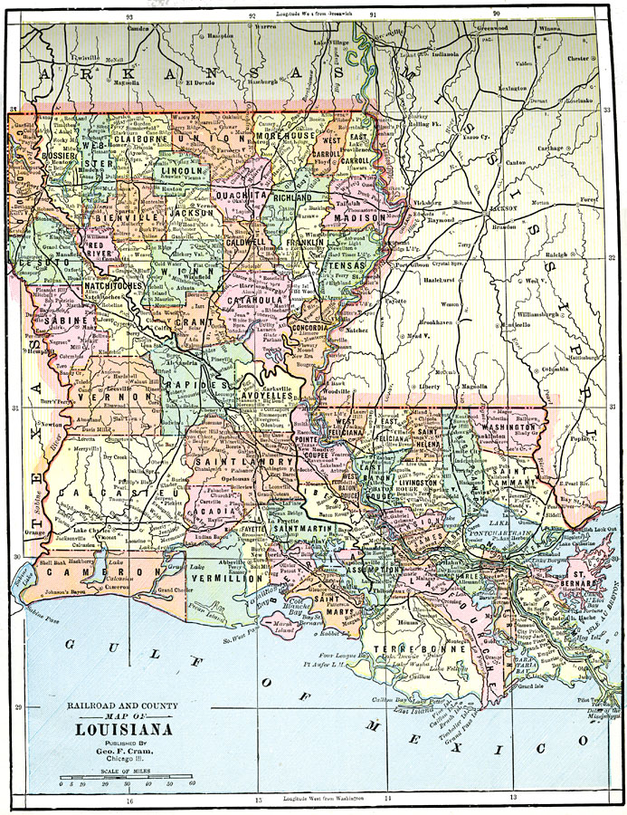
Description: A map from 1892 of Louisiana showing the State capital of Baton Rouge, counties and county seats, major cities and towns, railroads, lakes, rivers, the course of the Mississippi River, and coastal features of the Gulf of Mexico.
Place Names: Louisiana, Alexandria, �New Orleans, �Harrisonburg, �Columbia, �Leesville, �Baton Roug
ISO Topic Categories: boundaries,
inlandWaters,
location,
transportation
Keywords: Louisiana, physical, �political, �transportation, physical features, county borders, roads, boundaries,
inlandWaters,
location,
transportation, Unknown, 1892
Source: , The American Republic (Chicago, IL: John W. Iliff and Co., 1892) 65
Map Credit: Courtesy the private collection of Roy Winkelman |
|