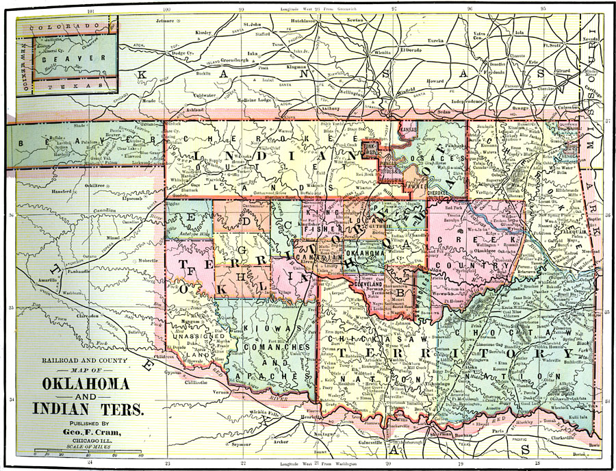
Description: A map from 1892 of Oklahoma and Indian Territories, showing railways, the county of Beaver in the northwest, the tribal divisions, major cities and towns, terrain, and rivers.
Place Names: Oklahoma, Oklahoma Territory, �Indian Territory, �Beaver, �Cherokee Indian Lands, �Creek Country, �Chickasaw Nation, �Choctaw Nation,
ISO Topic Categories: boundaries,
inlandWaters,
location,
transportation
Keywords: Oklahoma and Indian Territories, physical, �political, �transportation, physical features, county borders, railroads, boundaries,
inlandWaters,
location,
transportation, Unknown, 1892
Source: , The American Republic (Chicago, IL: John W. Iliff and Co., 1892) 67
Map Credit: Courtesy the private collection of Roy Winkelman |
|