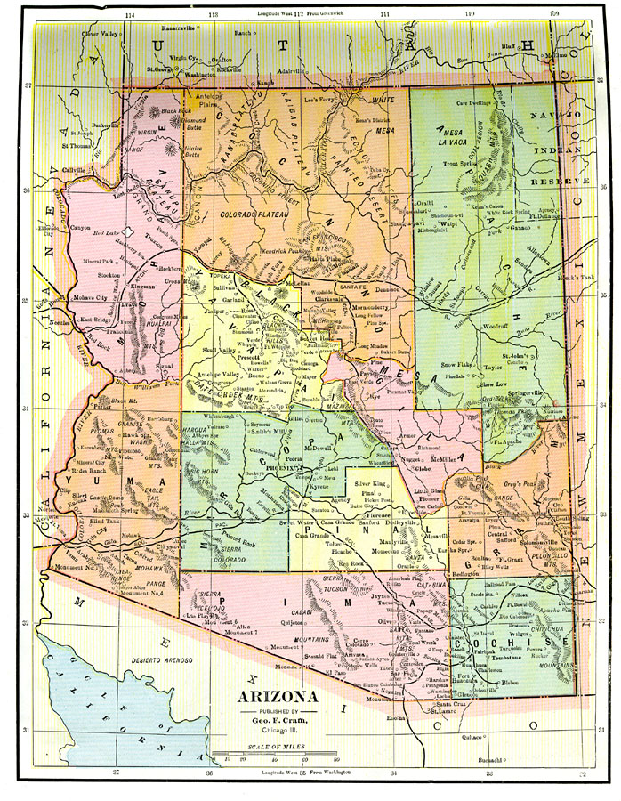
Description: A map of Arizona from 1892 showing the Territory capital of Phoenix, counties and county seats, major cities and towns, railroad lines, mountains, plateaus, rivers, and the Grand Canyon.
Place Names: Arizona, Yuma, �Phoenix, �Bisbee, �Tucson, �Prescott, �Glob
ISO Topic Categories: boundaries,
inlandWaters,
location,
transportation
Keywords: the Arizona Territory, physical, �political, �transportation, physical features, county borders, railroads, boundaries,
inlandWaters,
location,
transportation, Unknown, 1892
Source: , The American Republic (Chicago, IL: John W. Iliff and Co., 1892) 73
Map Credit: Courtesy the private collection of Roy Winkelman |
|