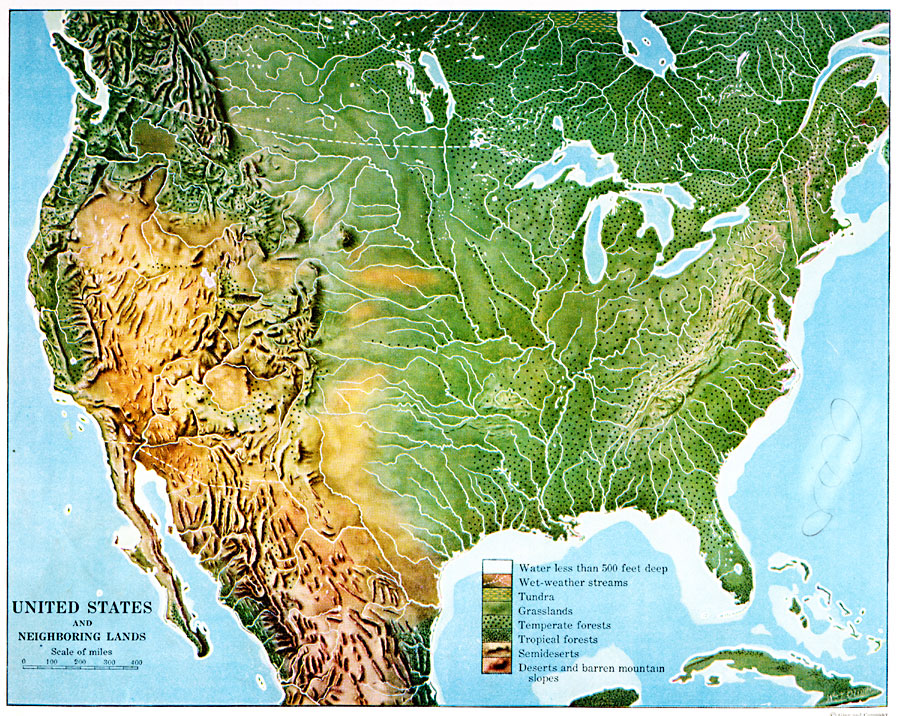
Description: A map from 1920 of southern Canada, the United States, and northern Mexico showing terrain features, lakes and river systems, and general vegetation types of the region. The map is keyed to show the submerged portion of the continental plateau, or water less than 500 feet deep, wet–weather streams, tundra lands, grasslands, temperate forests, tropical forests, areas of semi–deserts, and deserts or barren mountain slopes.
Place Names: A Regional Map of North America, United States, �Mexico, �Canada, �Cub
ISO Topic Categories: boundaries,
oceans,
location,
inlandWaters,
environment
Keywords: United States and Neighboring Lands, physical, kBiodiversity, physical features, boundaries,
oceans,
location,
inlandWaters,
environment, Unknown, 1920
Source: Wallace W. Atwood, New Geography: Book Two (Boston, MA: Ginn and Company, 1920) 83
Map Credit: Courtesy the private collection of Roy Winkelman |
|