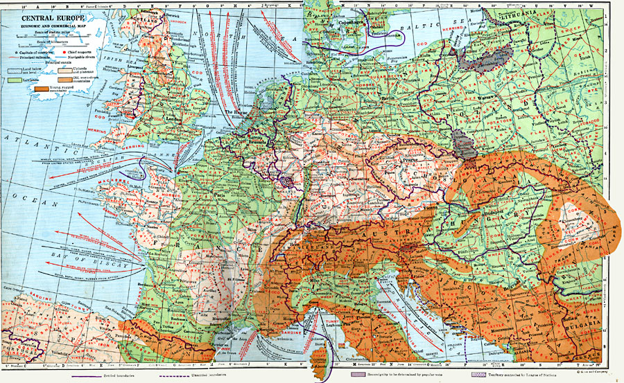
Description: An economic and commercial map of Central Europe in 1920 showing primary products, major ports and trade centers, railroads, navigable rivers, and steamship routes. Import and export information is provided. The map also shows general land elevations.
Place Names: Western and Central Europe, France, �Germany, �Spain, �Portugal, �Italy, �Sweden, �United Kingdom, �Poland, �Greece, �Romania, �Switzerland, �Austria, �Hungary, �Czechoslovakia, �Baltic States, �Lithuania, �
ISO Topic Categories: boundaries,
economy,
inlandWaters,
location,
planningCadastre
Keywords: Economic and Commercial Map of Central Europe, physical, �transportation, kEconomic, kTransportation, physical features, railroads,
water routes, boundaries,
economy,
inlandWaters,
location,
planningCadastre, Unknown, 1920
Source: Wallace W. Atwood, New Geography: Book Two (Boston, MA: Ginn and Company, 1920) 182-183
Map Credit: Courtesy the private collection of Roy Winkelman |
|