mapsMaps ETC Site map
 Maps ETC > Globes and Multi-continent > Regional Mediterranean > European and Asian Land East of the Mediterranean Sea., 1920
Site Map 

European and Asian Land East of the Mediterranean Sea., 1920

European and Asian Land East of the Mediterranean Sea.


Title: European and Asian Land East of the Mediterranean Sea.
Projection:
Source Bounding Coordinates:
W: 25 E: 30 N: 42 S: 40

Main Map Page
Zoomify Version
B/W PDF Version
Color PDF Version
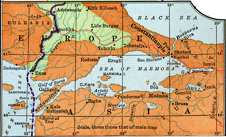
Description: European and Asian land located east of the Mediterranean Sea. Principal railroads are included.
Place Names: Regional Mediterranean, Europe, Asia, Bulgaria, Constantinople,
ISO Topic Categories: physical, transportation, kWorldMedSea, kWorldEurasia
Keywords: European and Asian Land East of the Mediterranean Sea., physical, transportation, physical features, railroads, physical, transportation, kWorldMedSea, kWorldEurasia, 1920
Source: Wallace W. Atwood, New Geography: Book Two (Boston, Massachusetts: Ginn and Company, 1920) 207
Map Credit: Courtesy the private collection of Roy Winkelman
SearchLicensePDF HelpGIS Help Google Earth Help Zoomify Help

 Maps ETC > Globes and Multi-continent > Regional Mediterranean > European and Asian Land East of the Mediterranean Sea., 1920
Site Map