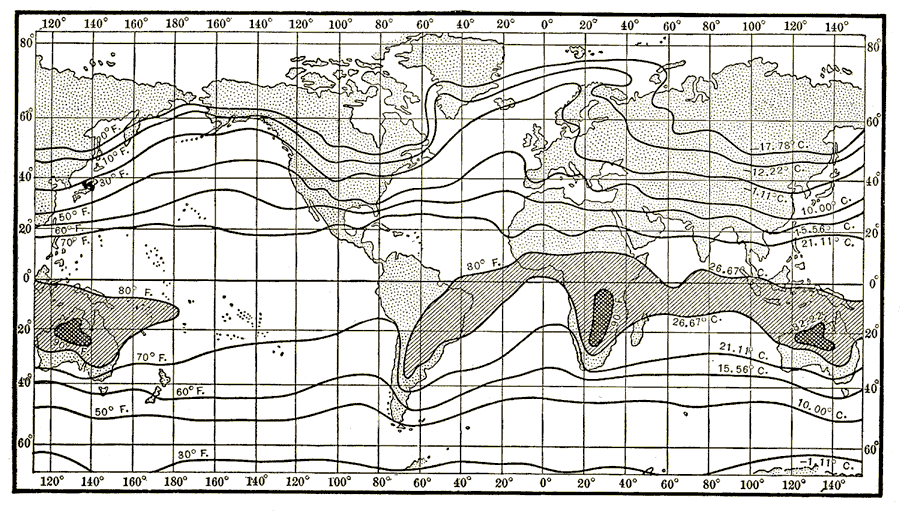
Description: An isothermal chart of the world from 1920 showing typical mean temperature patterns for the month of January. Temperatures are shown on the isotherms, given in both degrees Fahrenheit and Celsius.
Place Names: A Complete Map of Globes and Multi-continent, Africa, �Antarctica, �Asia, �Australia, �Europe, �North America, �South Americ
ISO Topic Categories: climatologyMeteorologyAtmosphere,
oceans,
location
Keywords: January Temperature Regions of the World, physical, �meteorological, kClimate, physical features, temperature, climatologyMeteorologyAtmosphere,
oceans,
location, Unknown, 1920
Source: Wallace W. Atwood, New Geography: Book Two (Boston, Massachusetts: Ginn and Company, 1920) 268
Map Credit: Courtesy the private collection of Roy Winkelman |
|