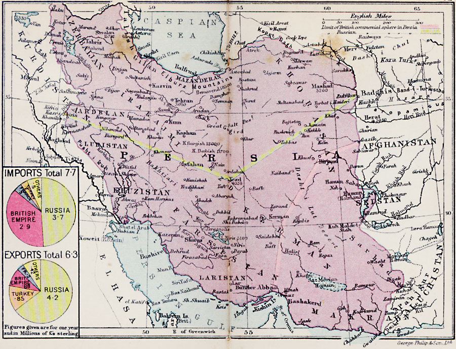
Description: A map from 1920 of Persia (Iran) at the time. The map shows major cities, railways, and rivers, with the limits of the British commercial sphere of influence in the southeast given by a pink border line, and the limits of the Russian commercial sphere of influence in the north given by a yellow border line. A pie chart shows the mean annual import and export figures for Persia, given in million £ sterling.
Place Names: Persia, Tabriz, �Balfrush, �Kashan, �Tehran, �Isfahan, �Hamun, �Bashakerd, �Masha
ISO Topic Categories: boundaries,
inlandWaters,
location,
oceans,
transportation
Keywords: Persia, physical, �political, �transportation, physical features, country borders, railroads, boundaries,
inlandWaters,
location,
oceans,
transportation, Unknown, 1920
Source: , Asprey's Atlas of the World (London, England: Asprey and Co., Ltd., 1920) 82
Map Credit: Courtesy the private collection of Roy Winkelman |
|