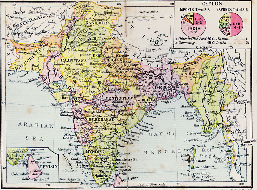
Description: The Indian EmpireA map from 1920 of the Indian Empire extending from Beluchistan on the Frontier with Persia and Afghanistan, to Burma on the frontier with Siam. The map shows the political boundaries and divisions at the time, capitals and major cities, railways, rivers, terrain and coastal features, and islands. An inset map details the island of Ceylon (Sri Lanka), and a chart shows the averaged annual percentages of imports and exports of Ceylon, broken down by country of trade.
Place Names: India , Baluchistan, �Rajputana, �Punjab, �Kashmir, �Hyderabad, �Mysore, �Dengal, �Assam, �Kashmi
ISO Topic Categories: boundaries,
elevation,
inlandWaters,
location,
oceans,
transportation
Keywords: Indian Empire, physical, �political, �transportation, physical features, country borders,
major political subdivisions, railroads, boundaries,
elevation,
inlandWaters,
location,
oceans,
transportation, Unknown, 1920
Source: , Asprey's Atlas of the World (London, England: Asprey and Co., Ltd., 1920) 86
Map Credit: Courtesy the private collection of Roy Winkelman |
|