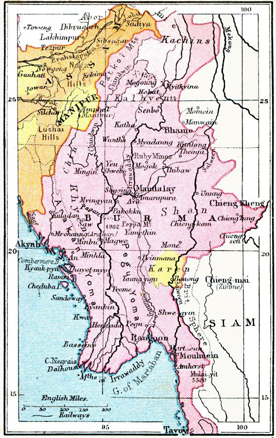
Description: A map from 1920 of the eastern portion of the Indian Empire from Sadiya in the Assam Province to Tavoy in the southern portion of Burma (Myanmar). The map shows Feudatory Native States in yellow, the British sphere of influence in Siam (Thailand), the province boundaries at the time, major cities, ports, railways, rivers, and coastal features of the region.
Place Names: India , Assam, �Manipur, �Burma, �Rangoon, �Akyab, �Mandalay, �Bhamo, �Lakhimpu
ISO Topic Categories: boundaries,
inlandWaters,
location,
oceans,
transportation
Keywords: Indian Empire — Eastern Portion, physical, �political, �transportation, physical features, country borders,
major political subdivisions, railroads, boundaries,
inlandWaters,
location,
oceans,
transportation, Unknown, 1920
Source: , Asprey's Atlas of the World (London, England: Asprey and Co., Ltd., 1920) 91
Map Credit: Courtesy the private collection of Roy Winkelman |
|