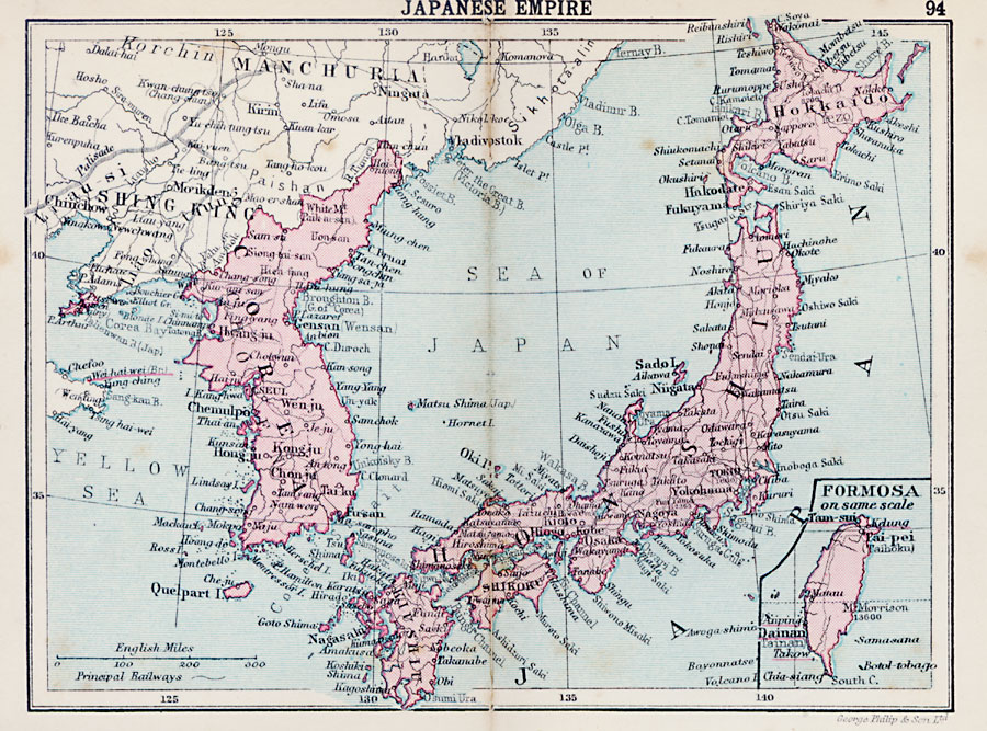
Description: A map from 1920 of the Japanese Empire at the time, which included the main islands of Hokkaido, Honshu, Shikoku, and Kiushiu, the Corea Peninsula, and the island of Formosa (Taiwan). The Kurile or Chishima Islands of northern Japan, the southern half of Sakhalin Island, and Ryukyu Islands to the south toward Taiwan are not shown on this map. Major cities, railways, rivers, islands, and coastal features are shown.
Place Names: Japan, Gensan, �Chemulo, �Kongju, �Nagasaki, �Fursan, �Kioto, �Osaka, �Hiogo, �Nagoya, �Yokohama, �Tokio, �Niigata, �Aikawa, �Miyako, �Fukuyama, �Hakodat
ISO Topic Categories: boundaries,
inlandWaters,
location,
oceans,
transportation
Keywords: Japanese Empire, physical, �political, �transportation, physical features, country borders, railroads, boundaries,
inlandWaters,
location,
oceans,
transportation, Unknown, 1920
Source: , Asprey's Atlas of the World (London, England: Asprey and Co., Ltd., 1920) 94
Map Credit: Courtesy the private collection of Roy Winkelman |
|