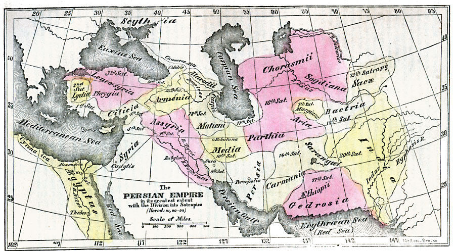
Description: A map of the Persian Empire at its greatest extent under Darius Hystaspes (Darius I), who reigned Persia from 522 to 486 BC. The map shows the boundaries of the twenty satrapies or provinces established by Darius from his capital Persepolis, and includes Ionia (1), Lydia (2), Leuco–syria or Phrygia (3), Cilicia (4), Syria (5), &Aelig;gyptus including Cyrenaica (6), Margiana (7), Susiana (8), Assyria (9), Media (10), Caspii or Hyrcania (11), Bactria (12), Armenia (13), Carmania and Sarangoei (14), Sacæ (15), Parthia including Chorasmii, Soydiana, and Aria (16), Gedrosia and &Aelig;thiopii (17), Matieni (18), Colchis (19), and India (20). This map shows major cities of the time and rivers.
Place Names: Southwest Asia, Armenia, �Assyria, �Lydia, �Mesopotamia, �Persia, �Syria, �Indi
ISO Topic Categories: inlandWaters,
location,
oceans
Keywords: The Persian Empire under Darius I, historical, country borders, inlandWaters,
location,
oceans, Unknown, 522–486 BC
Source: Marcius Willson, Willson's Outlines of History (New York, NY: Ivison & Phinney, 1859) 573
Map Credit: Courtesy the private collection of Roy Winkelman |
|
