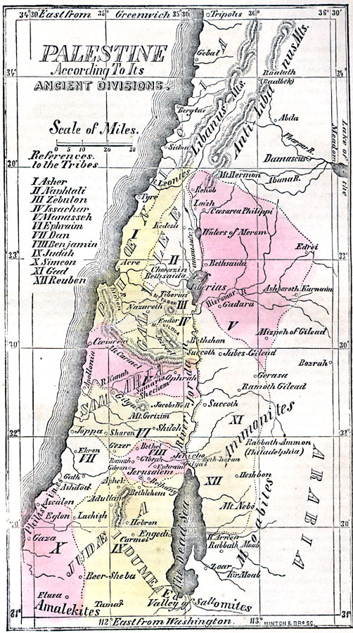
Description: A map from 1859 of the ancient divisions of Palestine under the Twelve Tribes of the Israelites. The map is keyed to show the lands of Asher (I), Naphtali (II), Zebulon (III), Issachar (IV), Manasseh (V), Ephraim (VI), Dan (VII), Benjamin (VIII), Judah (IX), Simeon (X), Gad (XI), and Ruben (XII). Significant historical sites are shown, including cities, mountains, rivers, lakes and seas, and coastal features. Longitude from Greenwich is given at the top of the map, longitude from Washington at the bottom.
Place Names: Palestine, Ammonites, �Galilee, �Judea, �Jerusalem, �Phenicia, �Samari
ISO Topic Categories: inlandWaters,
location,
oceans
Keywords: Palestine, according to its ancient divisions, historical, country borders, inlandWaters,
location,
oceans, Unknown, 500 BC
Source: Marcius Willson, Willson's Outlines of History (New York, NY: Ivison & Phinney, 1859) 575
Map Credit: Courtesy the private collection of Roy Winkelman |
|