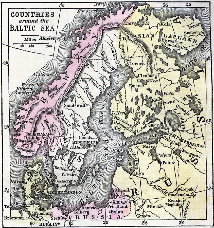
Description: A map of the countries surrounding the Baltic Sea during the Napoleonic War period (1792–1815). The map shows Norway, with its capital Christiania (Oslo), Sweden, Russian Lapland, portions of Prussia, and Denmark. The map shows major cities, ports, river and mountain systems, and the infamous Maelstrom (Moskstraumen) off the northern coast of Norway.
Place Names: Scandinavia, Denmark, �Norway, �Prussia, �Russia, �Sweden, St. Petersburg, Berlin, Stockholm, Christiania, Oslo, Russian Laplan
ISO Topic Categories: inlandWaters,
location,
oceans
Keywords: Countries around the Baltic Sea, borders, �historical, kNapoleonicWars, country borders,
county borders, historical event, inlandWaters,
location,
oceans, Unknown, 1789
Source: Marcius Willson, Willson's Outlines of History (New York, NY: Ivison & Phinney, 1859) 591
Map Credit: Courtesy the private collection of Roy Winkelman |
|