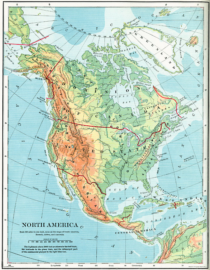
Description: A map from 1902 of North America showing national boundaries, terrain features, and general land elevations for the region. The map is color–coded to show highlands over 2000 feet above sea level in buff tints, lowlands in greens, and the submerged part of the continental plateau to 6000 ft. below sea level in light blue. The land elevation contours of 1000 feet, 2000 feet, and 4000 feet are shown. The map shows mountain systems, lakes, rivers, and coastal features.
Place Names: A Complete Map of North America, Bahamas, �Canada, �Central America, �Cuba, �Haiti, �Mexico, �United State
ISO Topic Categories: oceans,
location,
inlandWaters
Keywords: North America, borders, �historical, country borders, oceans,
location,
inlandWaters, Unknown, 1902
Source: H. Justin Roddy, Complete Geography (New York, NY: American Book Company, 1902) 24
Map Credit: Courtesy the private collection of Roy Winkelman |
|