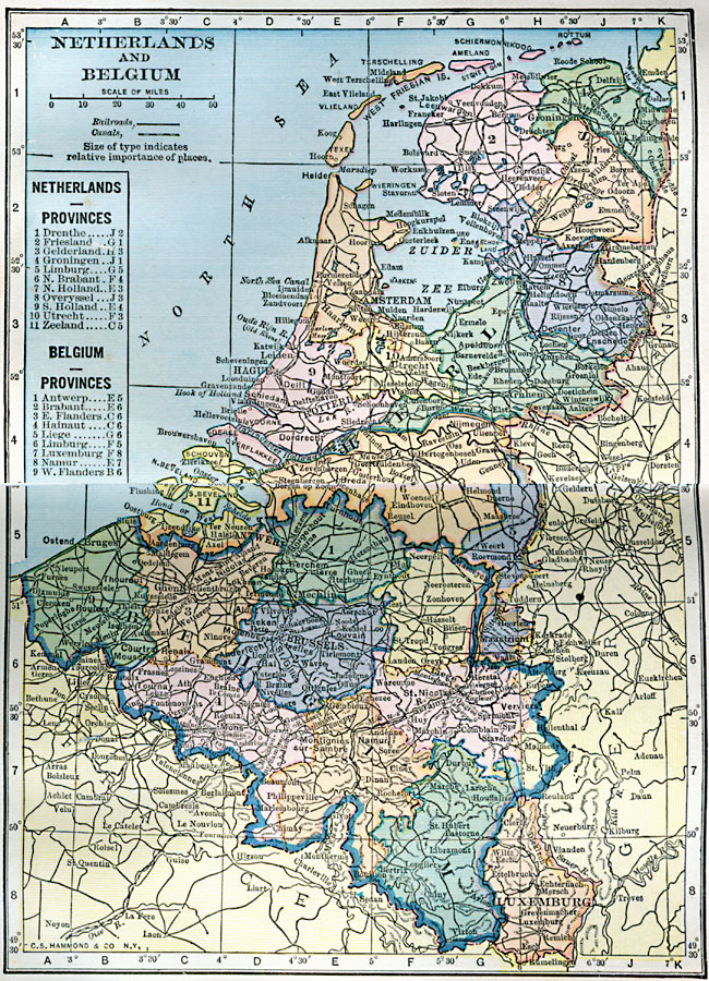
Description: A map of the Netherlands, Belgium, and Luxemburg in 1922, showing province boundaries, major cities and ports, railroads, canals, rivers and hilly areas of the region. This map has a reference key to the provinces of the Netherlands and Belgium.
Place Names: Low Countries, Netherlands, �Belgium, �Luxemburg
ISO Topic Categories: inlandWaters,
location,
oceans,
boundaries,
transportation
Keywords: Netherlands and Belgium, physical, �political, �transportation, physical features, country borders, railroads,
water routes, inlandWaters,
location,
oceans,
boundaries,
transportation, Unknown, 1922
Source: , Putnam's Handy Map Book (New York, NY: G. P. Putnam's Sons, 1922) 14-15
Map Credit: Courtesy the private collection of Roy Winkelman |
|