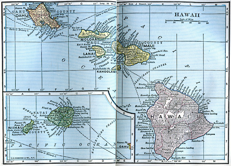
Description: A map from 1922 of the Hawaiian Islands showing the eight main islands of Hawaii, Maui, Kahoolawe, Lanai, Molokai, Oahu, and in the inset Kauai and Niihau, the capital of Honolulu on the island of Oahu, cities, towns, ports, railroads, submarine cable routes, volcanoes, and coastal features.
Place Names: Hawaii,
ISO Topic Categories: location,
oceans
Keywords: Hawaii, physical, physical features, location,
oceans, Unknown, 1922
Source: , Putnam's Handy Map Book (New York, NY: G. P. Putnam's Sons, 1922)
Map Credit: Courtesy the private collection of Roy Winkelman |
|