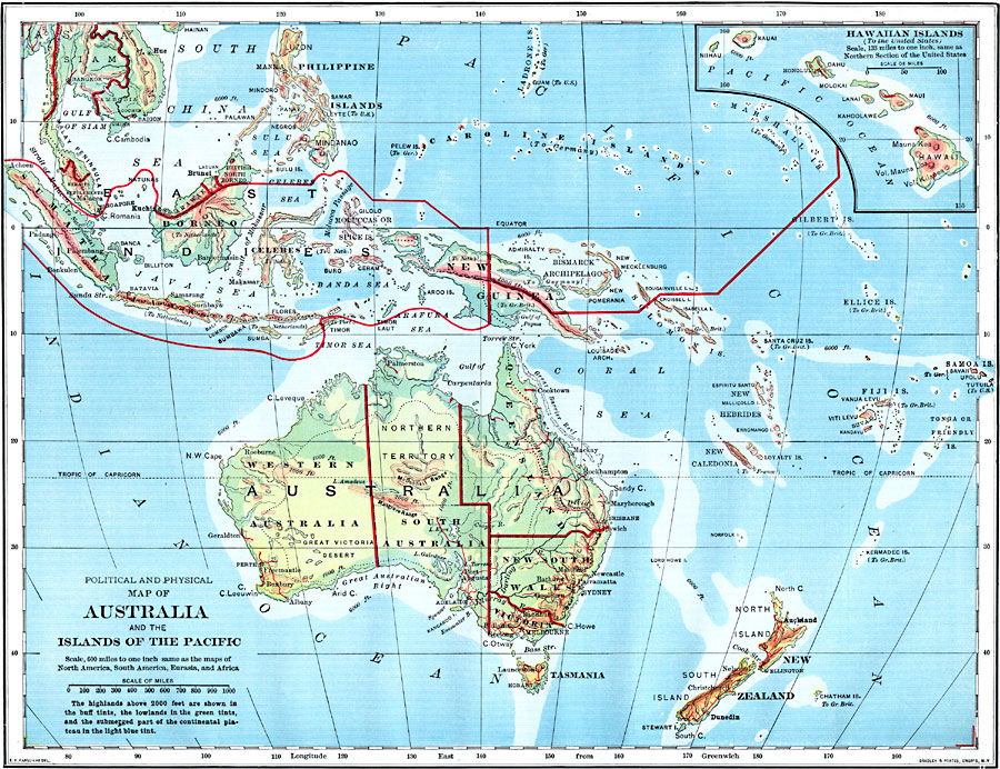
Description: A political and physical map of Australia and the islands of the Pacific in 1902, showing general elevations and water depths, European and US territorial claims, major cities, railways, rivers, and mountain systems. The inset map details the Hawaiian Islands. Elevations and water depths are color–coded to show highlands above 2000 feet in buff tints, lowlands in green tints, and submerged portions of continental plateaus in light blue tint.
Place Names: Regional Pacific Ocean, Alice Springs, �Brisbane, �Cairns, �Canberra, �Darwin, �Mackay, �Melbourne, �Newcastle, �Sydney, �Townsvill
ISO Topic Categories: borders, �historical, �transportation, �meteorological, kWorldPacific
Keywords: Political and Physical Map of Australia and the Islands of the Pacific, borders, �historical, �transportation, �meteorological, physical features, railroads,
water routes, climate, borders, �historical, �transportation, �meteorological, kWorldPacific, Unknown, 1902
Source: H. Justin Roddy, Complete Geography (New York, NY: American Book Company, 1902) 134
Map Credit: Courtesy the private collection of Roy Winkelman |
|
