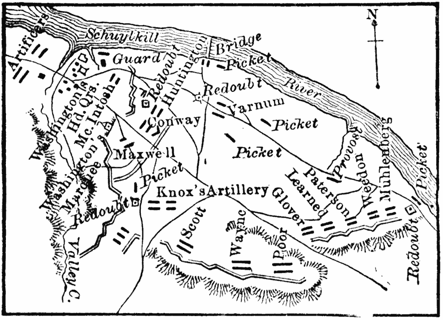
Description: A plan of the winter encampment at Valley Forge, 1777–1778. The map shows the Schuylkill River, redoubts, Washington's headquarters, and unit positions.
Place Names: Pennsylvania, Valley For
ISO Topic Categories: inlandWaters,
location,
intelligenceMilitary
Keywords: Encampment at Valley Forge, physical, �historical, kAmericanRevolution,physical features, American Revolution, inlandWaters,
location,
intelligenceMilitary, Unknown, 1777–1778
Source: John Clark Ridpath, L.L. D, Cyclopedia of Universal History (Cincinnati, OH: The Jones Brothers Publishing Co., 1885) 971
Map Credit: Courtesy the private collection of Roy Winkelman |
|