mapsMaps ETC Site map
 Maps ETC > Europe > A Complete Map of Europe > Europe during the time of Napoleon I, 1804–1814
Site Map 

Europe during the time of Napoleon I, 1804–1814

Europe during the time of Napoleon I


Title: Europe during the time of Napoleon I
Projection: Unknown,
Source Bounding Coordinates:
W: -15 E: 50 N: 60 S: 35

Main Map Page
Zoomify Version
B/W PDF Version
Color PDF Version
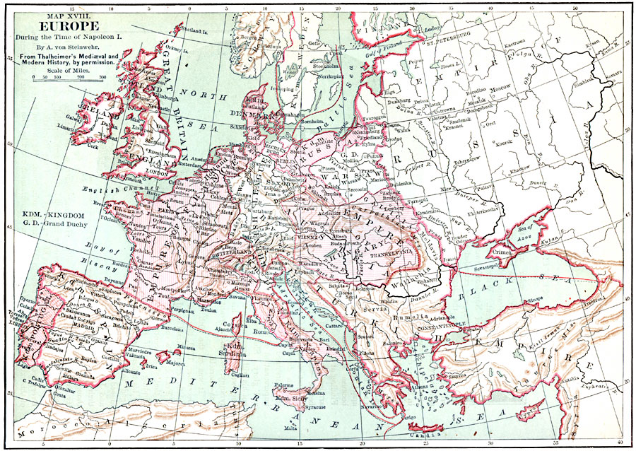
Description: Europe, during the Time of Napoleon 1.
Place Names: A Complete Map of Europe, Portugal, Spain, England, Prussi
ISO Topic Categories: inlandWaters, location, oceans, boundaries
Keywords: Europe during the time of Napoleon I, physical, political, physical features, country borders, inlandWaters, location, oceans, boundaries, Unknown, 1804–1814
Source: John Clark Ridpath, L.L. D, Cyclopedia of Universal History (Cincinnati, OH: The Jones Brothers Publishing Co., 1885) 1056
Map Credit: Courtesy the private collection of Roy Winkelman
SearchLicensePDF HelpGIS Help Google Earth Help Zoomify Help

 Maps ETC > Europe > A Complete Map of Europe > Europe during the time of Napoleon I, 1804–1814
Site Map