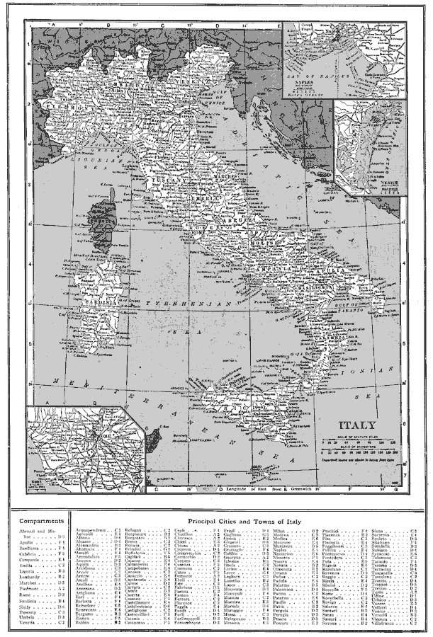
Description: Rome in 1917.
Place Names: Italy, Rome, �Ponte Galera, �Muratella, �Salone, �Vatica
ISO Topic Categories: inlandWaters,
oceans,
location,
boundaries
Keywords: Rome, physical, �political, physical features, country borders,
major political subdivisions, inlandWaters,
oceans,
location,
boundaries, Unknown, 1917
Source: Francis J. Reynolds, The New Encyclopedic Atlas and Gazetteer of the World (New York, New York: P. F. Collier and Son, 1917) 141
Map Credit: Courtesy the private collection of Roy Winkelman |
|