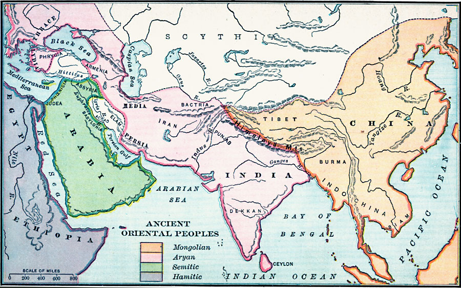
Description: A map of southern Asia and eastern Africa showing territories of the early inhabitants. The map is color–coded to show the territories of the Mongolians in China, Tibet, Burma, and Indo–China, the Aryans in Thrace, Lydia, Phrygia, Armenia, Media, Bactria, Iran, Persia, Punjab, Dekkan, and India, the Semitics in Phoenicia, Judea, Assyria, Babylonia, and Arabia, and the Hamitics in Egypt and Ethiopia. The map also shows the territories of the Hittites, and the territories of Elam, Scythia, and Accad, major rivers, mountain systems, lakes, and large bodies of water.
Place Names: Regional Miscellaneous, Asia, �Arabia,�China, �Egypt, �India,
ISO Topic Categories: borders, �political, kWorldMedSea, kWorldAfroAsia, kWorldEurasia
Keywords: Ancient Oriental Peoples, borders, �political, major political subdivisions, borders, �political, kWorldMedSea, kWorldAfroAsia, kWorldEurasia, Unknown, 753–509 BC
Source: William C. Morey, Outlines in Greek History with a survey of Ancient Oriental Nations (New York, NY: The Athenium Press, 1908) 20
Map Credit: Courtesy the private collection of Roy Winkelman |
|