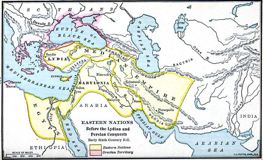
Description: A map of the Greek and eastern nations showing the regional territories before the period of Lydian and Persian conquests. This map is color–coded to show the Grecian territories outlined in pink and the eastern nations outlined in yellow. The map shows the territories of Lydia, Cilicia, Babylonia, Phoenicia, Bactria, Egypt, and the Median Empire including Armenia, Media, and Persia. This map shows the boundaries before the Lydia conquest under King Gyges of the Greek cities in 560 BC.
Place Names: Regional Miscellaneous, Asia, �Babylonia, �Cilicia, �Europe, �Lydi
ISO Topic Categories: borders, �political, kAncientGreece, kWorldMedSea, kWorldAfroAsia, kWorldEurasia
Keywords: Eastern Nations Before the Lydian and Persian Conquests, borders, �political, kAncientGreece, major political subdivisions, borders, �political, kAncientGreece, kWorldMedSea, kWorldAfroAsia, kWorldEurasia, Unknown, 560 BC
Source: William C. Morey, Outlines in Greek History with a survey of Ancient Oriental Nations (New York, NY: The Athenium Press, 1908) 166
Map Credit: Courtesy the private collection of Roy Winkelman |
|