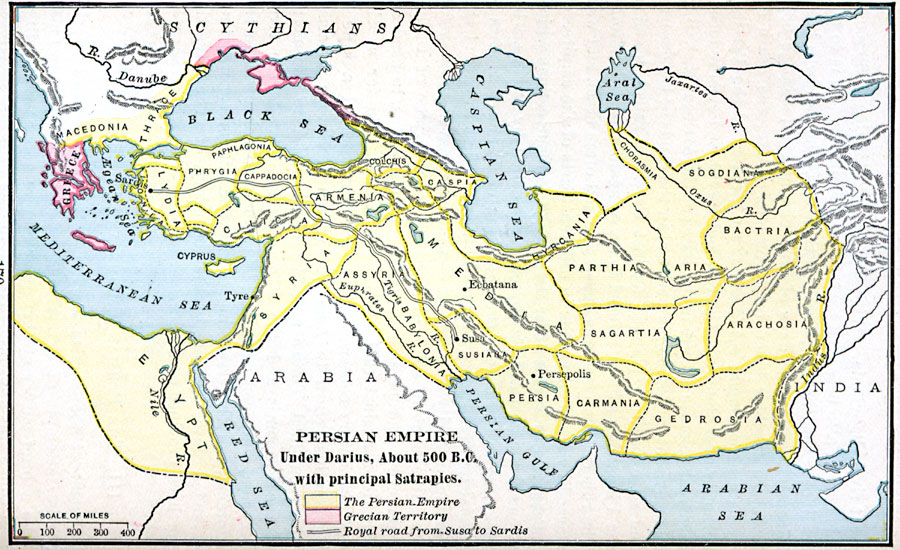
Description: A map showing the Persian Empire under Darius I (522–486 BC). The map is color–coded to show the Grecian territory at the time in pink, and the Persian Empire outlined in yellow. This map shows the territories of Thrace, Macedonia, and the islands of the &Aelig;gean Sea under Persian control, and shows the Persian Satrapies (Provinces) of Lydia, Phrygia, Paphlagonia, Cappadocia, Cilicia, Armenia, Colchis, Caspia, Hyrcania, Parthia, Aria, Chorasmia, Sogdiana, Bactria, Arachosia, Sagartia, Media, Susiana, Persia, Carmania, Gedrosia, Assyria, Babylonia, Egypt, Cyprus, and Syria. The map shows major cities of the period, and the Royal Road from Susa to Sardis.
Place Names: Regional Miscellaneous, Assyria, �Babylonia, �Cilicia, �Egypt, �Europe, �Greece, �Lydia, �Macedonia, �Syri
ISO Topic Categories: borders, �political, kWorldMedSea, kWorldAfroAsia, kWorldEurasia
Keywords: Persian Empire under Darius, borders, �political, major political subdivisions, borders, �political, kWorldMedSea, kWorldAfroAsia, kWorldEurasia, Unknown, 522–486 BC
Source: William C. Morey, Outlines in Greek History with a survey of Ancient Oriental Nations (New York, NY: The Athenium Press, 1908) 170
Map Credit: Courtesy the private collection of Roy Winkelman |
|