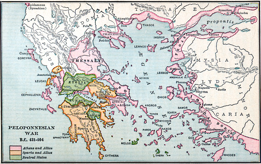
Description: A map showing the Greek and Asia Minor region during the Peloponnesian War between the Athenians and Spartans in 431-404 B.C. The map is color-coded to show the Athenian and allied territories, the neutral states, and the territories of the Spartans and allies. The map shows the extent of the Athenian influence, including Attica, Thessaly, the majority of islands and coastal territories of the Aegean Sea (including the areas around the Propontis from Hellespont to the Bosphorus, and the coast of Asia Minor), and Corcyra (Corfu) and Epidamnus (Dyrrachium or Durrës, Albania) on the Ionian Sea. The Spartan influences include Elts, Arcadia, Messenia, Corinth, and Laconia on the Peloponnese peninsula, Boetoia to the north of Attica, and the island and mainland territories of Leucas. The neutral territories in the conflict include Aetolia, Achaia, Argolis, and the islands of Melos and Thera.
Place Names: Southeastern Europe, Acropolis, �Athens, �Doris, �Etolia, �Greece, �Ionia, �Parthenon, �Thessaly, �Troas, Sparta, Bosphorus
ISO Topic Categories: oceans,
location,
inlandWaters
Keywords: Peloponnesian War, borders, �political, �historical, kAncientGreece, major political subdivisions, other military, oceans,
location,
inlandWaters, Unknown, 431–404 B.C.
Source: William C. Morey, Outlines in Greek History with a survey of Ancient Oriental Nations (New York, NY: The Athenium Press, 1908) 262
Map Credit: Courtesy the private collection of Roy Winkelman |
|