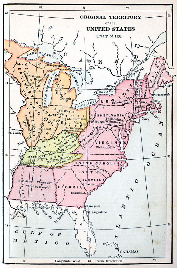
Description: A map of the United States showing the territorial growth from 1783 to 1790. The map is color–coded to show the original territory after the American Revolutionary War, the Northwest Territory north of the Ohio River in 1787, the territory south of the Ohio River in 1790, and the Mississippi Territory. The map gives the dates of the admission to the Union of the states in the territories, and notes the cession of Florida by Spain in 1819.
Place Names: Growth of Nation, Boston, �New York, �Philadelphia, �Savannah, �Trenton, �Treaty of 1832, �Territory North of the Ohio, �Territory South of the Ohio, �Mississippi Territor
ISO Topic Categories: oceans,
location,
inlandWaters
Keywords: Original Territory of the United States, borders, �historical, historical event, oceans,
location,
inlandWaters, Unknown, 1783–1790
Source: Harry Pratt Judson, LL.D., The Young American - A Civic Reader (New York, NY: Maynard Merrill & Co. , 1897)
Map Credit: Courtesy the private collection of Roy Winkelman |
|