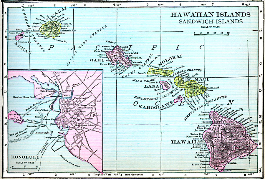
Description: A map from 1920 of the Hawaiian Islands or Sandwich Islands, showing the main islands, towns, ports, volcanoes, terrain, and coastal features. An inset map details the capital Honolulu and Quarantine Island.
Place Names: Hawaii, Hana, �Hilo, �Honolulu, �Kaneohe, �Kuamalapau, �Makaha, �Pahoa, �Pearl City, �Puuwai, �Waime
ISO Topic Categories: oceans,
inlandWaters,
location
Keywords: Hawaiian Islands (Sandwich Islands), borders, oceans,
inlandWaters,
location, Unknown, 1920
Source: James M. Miller and H.S. Canfield, The People's War Book - History, Cyclopedia, and Chronology of the Great War (Cleveland, OH: R.C. Barnum Co., 1920) 295
Map Credit: Courtesy the private collection of Roy Winkelman |
|