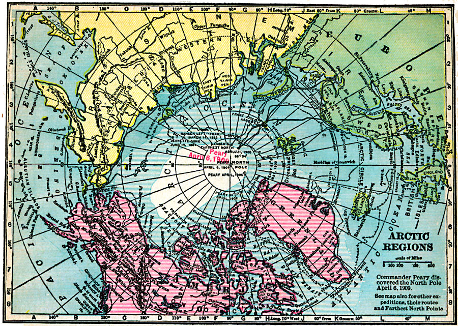
Description: A map of the North Polar Region from 1920 showing the routes of Arctic expeditions, from the sinking of the USS Jeanette in 1881 to the date that Commander Peary first reached the North Pole (April 6, 1909). The map shows the routes George De Long (1881), Fridtjof Nansen (1893–1896), Duke of the Abruzzi (1899–1900), and the Peary expeditions of 1900, 1902, 1906, and 1909.
Place Names: Arctic Region, Alaska, �Canada, �Greenland, �Iceland, �Russi
ISO Topic Categories: oceans,
inlandWaters,
location
Keywords: Arctic Region Exploration, borders, oceans,
inlandWaters,
location, Unknown, 1850–1909
Source: James M. Miller and H.S. Canfield, The People's War Book - History, Cyclopedia, and Chronology of the Great War (Cleveland, OH: R.C. Barnum Co., 1920) 336
Map Credit: Courtesy the private collection of Roy Winkelman |
|