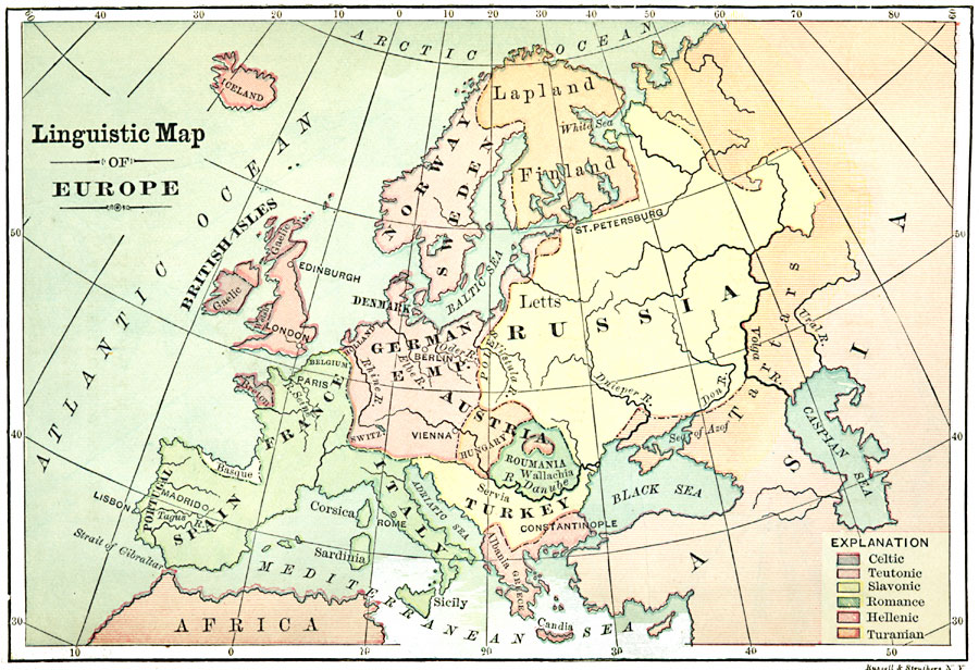
Description: A linguistic map showing the regional identification of language groups spoken in Europe, including Celtic, Teutonic, Slavonic, Romance, Hellenic, and Turanian.
Place Names: A Complete Map of Europe, France, �Spain, �Portugal, �Sweden, �Italy, �United Kingdom, �Germany, �Greece, �Romania, �Roumania, �Austria, �British Isles,
ISO Topic Categories: location,
inlandWaters,
oceans,
society
Keywords: Linguistic Map of Europe, physical, kLanguage, physical features, location,
inlandWaters,
oceans,
society, Unknown, 1901
Source: John D. Quackenbos, Illustrated History of Ancient Literature, Oriental and Classical (New York, New York: Harper and Brothers, 1901)
Map Credit: Courtesy the private collection of Roy Winkelman |
|