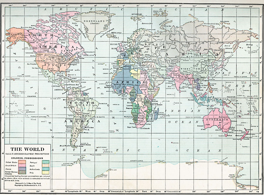
Description: A world map from 1920 on a Gall's Stereographic Projection (a conformal, or angle–preserving projection similar to Mercator's), color–coded to show countries having foreign or colonial possessions, including the United States, Great Britain, France, Portugal, Spain, Netherlands, and Italy. The map also shows the former German colonies.
Place Names: A Complete Map of Globes and Multi-continent, Africa, �Antarctica, �Asia, �Australia, �Europe, �North America, �South Americ
ISO Topic Categories: boundaries,
location,
inlandWaters,
oceans
Keywords: World Map, physical, �political, kMapProjection, physical features, country borders, boundaries,
location,
inlandWaters,
oceans, Unknown, 1920
Source: , Hammond's Modern Atlas of the World (New York, New York: C. S. Hammond and Company, Inc., 1920) 1
Map Credit: Courtesy the private collection of Roy Winkelman |
|