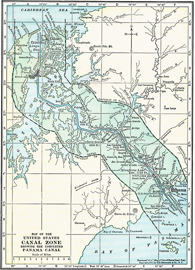
Description: A map from 1920 of the United States Canal Zone showing the completed Panama Canal. The map shows the entrance ports of Colon on the Caribbean Sea and the city of Panama on the Pacific, the Panama Railroad, the original portion of the canal by the French, lakes and water elevations, feeding rivers, location of the locks, the boundary line between the Canal Zone and the Republic of Panama, and the continental divide.
Place Names: Panama Canal Zone, Cristobal, �Panama, �Colo
ISO Topic Categories: boundaries,
location,
inlandWaters,
oceans,
transportation
Keywords: Panama Canal Zone, physical, �transportation, physical features, water routes, boundaries,
location,
inlandWaters,
oceans,
transportation, Unknown, 1920
Source: , Hammond's Modern Atlas of the World (New York, NY: C. S. Hammond and Company, Inc., 1920) 16
Map Credit: Courtesy the private collection of Roy Winkelman |
|