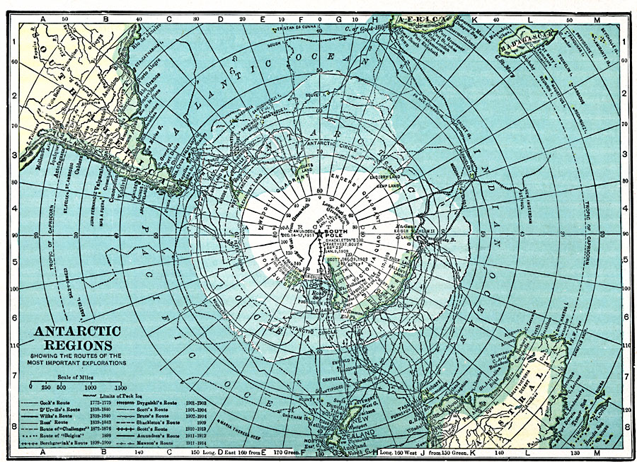
Description: A map of the South Polar Region from 1920 showing the routes of several Antarctic explorations. The map shows the route used and date Amundsen first reached the South Pole (December 14–17, 1911), and routes of Cook (1772–1775), D'Urville (1838–1840), Wilke (1839–1840), Ross (1839–1843), Borchgrevink (1898–1900), Drygalaki (1901–1903), Scott (1901–1904), Bruce (1902–1904), and Shackleton (1909). This map shows Antarctica divided into the Wendell Quadrant, Enderby Quadrant, Victoria Quadrant, and Ross Quadrant.
Place Names: Antarctic Region, Dumont dUrville (France
ISO Topic Categories: location,
oceans
Keywords: Exploration of the Antarctic Regions, physical, �historical, physical features, historical event, location,
oceans, Unknown, 1920
Source: , Hammond's Modern Atlas of the World (New York, NY: C. S. Hammond and Company, Inc., 1920) 32
Map Credit: Courtesy the private collection of Roy Winkelman |
|