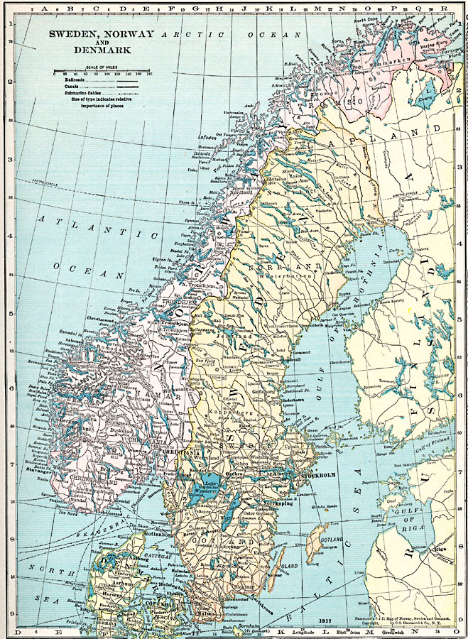
Description: A map from 1920 of Sweden, Norway, and Denmark, showing country boundaries and capitals, principal cities and towns, railroads, canals, submarine cable routes, mountain systems, lakes, rivers, islands, and coastal features.
Place Names: Scandinavia, Sweden, �Norway, �Denmark, �Copenhagen, �Stockholm, �Christiania,
ISO Topic Categories: boundaries,
location,
inlandWaters,
transportation
Keywords: Sweden, Norway, and Denmark, physical, physical features, boundaries,
location,
inlandWaters,
transportation, Unknown, 1920
Source: , Hammond's Modern Atlas of the World (New York, NY: C. S. Hammond and Company, Inc., 1920) 41
Map Credit: Courtesy the private collection of Roy Winkelman |
|