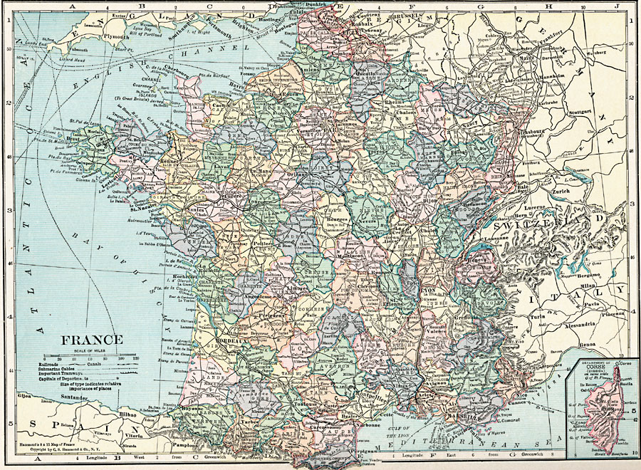
Description: A map of France in 1920, showing major cities and towns, rivers, railroads, canals, submarine cables, and important tramways. This map is color–coded to show the administrative Departments of France with their capitals circled. An inset map shows the French controlled island of Corsica.
Place Names: France, Bordeaux, �Paris, �Starsbourg, �Lyon, �Orleans, �Dunkerque, �Grenoble, �Nancy, �Nice, �Tour
ISO Topic Categories: boundaries,
inlandWaters,
location,
oceans,
transportation
Keywords: France, physical, �transportation, physical features, railroads, boundaries,
inlandWaters,
location,
oceans,
transportation, Unknown, 1920
Source: , Hammond's Modern Atlas of the World (New York, New York: C. S. Hammond and Company, Inc., 1920) 42
Map Credit: Courtesy the private collection of Roy Winkelman |
|