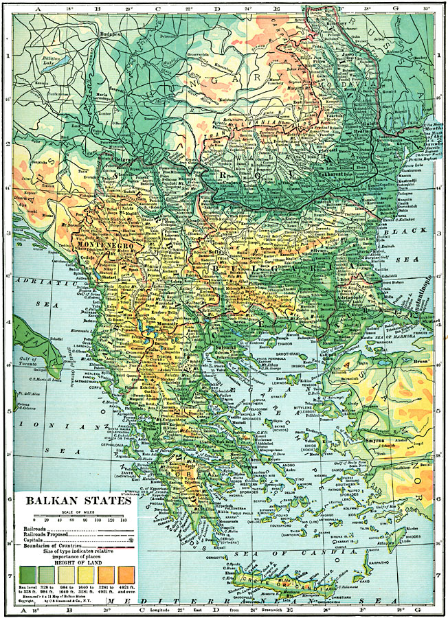
Description: A map from 1920 of the Balkan States, showing country boundaries and capitals, principal cities and towns, railroads, proposed railroads, mountain systems, lakes, rivers, islands, and coastal features. The map uses color–contouring to show height of land from sea level to 4921 feet and above.
Place Names: Southeastern Europe, Romania, �Montenegro, �Albania, �Greece, �Serbia, �Bulgaria, �Roumania, �Crete, �Candia,
ISO Topic Categories: boundaries,
location,
inlandWaters,
transportation,
elevation
Keywords: Balkan States, physical, �transportation, physical features, railroads, boundaries,
location,
inlandWaters,
transportation,
elevation, Unknown, 1920
Source: , Hammond's Modern Atlas of the World (New York, NY: C. S. Hammond and Company, Inc., 1920) 47
Map Credit: Courtesy the private collection of Roy Winkelman |
|